
Key takeaways
- After a hurricane in Port Arthur, the main dispute is often cause: wind (covered by TWIA or a wind policy) vs. flood, storm surge, or rising water (covered only by a flood policy).
- Wind-driven rain through a storm-created opening is generally a wind/property claim, not a flood claim.
- One storm can mean two or three claims, with separate adjusters, deductibles, and deadlines.
- Water lines, upper-wall and ceiling damage, debris patterns, timing, and NWS/NHC data are the evidence that settles most allocation questions.
- Some policies contain anti-concurrent causation language that can affect mixed wind/flood losses. Policy wording controls.
In Southeast Texas, a single hurricane can tear off shingles, blow rain through broken windows, and push water across the floor in the same night. Insurance does not treat those as one loss. The question of wind vs. flood damage decides which policy pays, which deductible applies, and whether any coverage responds at all. For Port Arthur homeowners and business owners, getting that allocation right is often the difference between a fair claim and a frustrating one.
This guide explains how insurers separate wind damage from flood damage, why wind-driven rain is treated differently from rising water, what evidence adjusters rely on, and how to handle separate TWIA and flood adjusters. It is general information, not legal advice, and your policy language always controls.
Why wind vs. flood damage matters so much in Port Arthur
Jefferson County is a TWIA first-tier coastal county, according to the Texas Department of Insurance. That means many Port Arthur, Groves, Nederland, Port Neches and Sabine Pass properties carry a stack of policies that each cover a different peril:
- A homeowners or commercial property policy that may exclude wind and hail in the catastrophe area.
- A TWIA policy covering wind and hail.
- An NFIP or private flood policy covering flood, including storm surge and rising water.
Standard homeowners and commercial policies generally exclude flood, and TWIA does not cover it either. So if wet drywall is called "flood," it falls to the flood policy, if one exists. If it is called "wind" or "wind-driven rain," it falls to the wind policy. When the owner has no flood coverage, the label assigned to the damage can decide whether anything is paid for that part of the loss.
Local geography makes this harder. Port Arthur sits low along Sabine Lake and the Gulf, with neighborhoods behind the city's hurricane flood protection levee and seawall system. That system reduces storm surge risk, but it does not stop rainfall flooding. Hurricane Harvey in 2017 and Tropical Storm Imelda in 2019 both flooded large parts of Jefferson County with rain. Areas outside the levee, such as Sabine Pass and Pleasure Island, face more direct surge exposure, as Hurricane Ike showed in 2008.
How each type of damage is usually classified
| What happened | Usually treated as | Which policy typically responds |
|---|---|---|
| Wind tears shingles or decking off the roof | Wind damage | TWIA or wind-covering property policy |
| Rain blows in through a broken window or torn roof | Wind-driven rain through a storm-created opening | TWIA or property policy (subject to opening requirements) |
| Rain enters through an old roof with no new opening | Often wear and tear or deterioration | Often excluded or disputed |
| Storm surge pushes Gulf or lake water into the home | Flood | NFIP or private flood policy |
| Street drainage overwhelmed, water rises into the house | Flood (surface water) | NFIP or private flood policy |
| Tree falls in high winds and punctures the roof | Wind damage | TWIA or property policy |
| Roof damage plus floor-level flooding in the same storm | Mixed-cause loss | Both: wind policy for wind portion, flood policy for flood portion |
Wind-driven rain is not flood
A common misunderstanding after a hurricane is that any water inside the house is "flood." It is not. Wind-driven rain that enters through an opening the storm created, such as missing shingles, peeled-back flashing, a blown-out window, or a damaged soffit, is generally evaluated under the wind or property policy.
The catch is the opening. Many policies only cover interior rain damage if wind or hail first creates an opening in the roof or walls. If the insurer believes the rain came through an aging roof or through gaps that existed before the storm, it may deny that part of the claim as wear and tear. That makes exterior documentation essential: photograph every opening and connect it to the storm date.
Wind-driven rain damage also tends to look different from flood damage. It usually shows up high in the structure, in ceilings, attic insulation, the tops of walls, and around window and door frames on the windward side. Flood damage rises from the floor up, roughly level across rooms.

The evidence adjusters use to separate wind from water
Insurers and their engineers do not decide cause by guesswork. They look for physical and timeline evidence. You should gather the same evidence, ideally before repairs erase it.
Water lines
Rising water leaves a line on walls, cabinets, doors, appliances, and fences. A consistent horizontal line across several rooms and the exterior points to flood. Measure it from the floor and photograph it with a tape measure in view. Then document everything above that line separately.
Damage above the water line
Wet ceilings, stained upper walls, soaked attic insulation, and damaged roof decking cannot be explained by water rising from the ground. These areas are strong evidence of wind or wind-driven rain. Photograph them from several angles and note which side of the house they are on.
Debris and exterior patterns
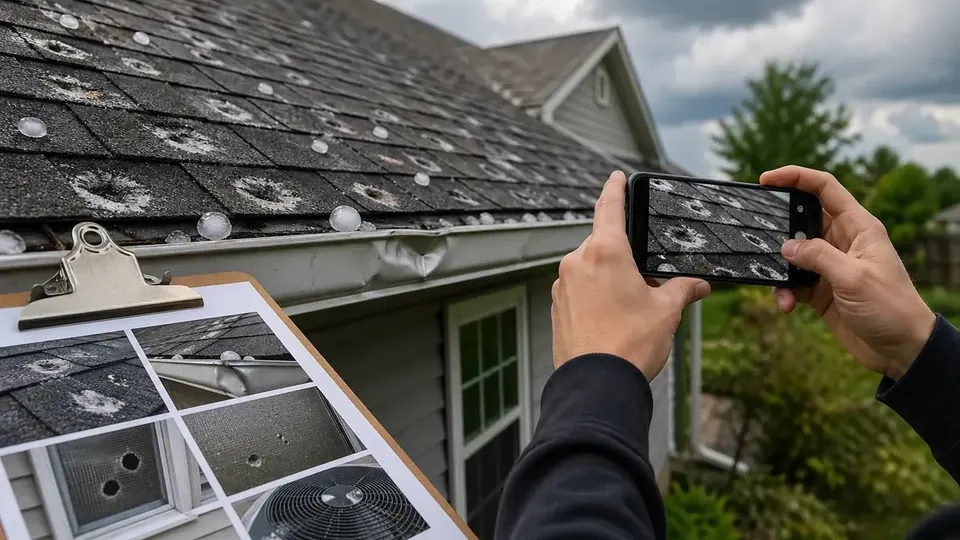
Wrack lines of grass, marsh debris, and trash on walls or fences show how high water reached outside. Missing shingles, lifted ridge caps, bent metal roofing, damaged fences laid flat in one direction, and broken windows point to wind. Engineers often compare the direction of damage to the storm's wind field.
Timing
When did the ceiling start dripping? When did water first come under the door? In many hurricanes the strongest winds arrive before or during the surge or peak rainfall. A simple written timeline, with times from text messages, photos, or videos, can help separate the two. Phone photo metadata often records the exact time.
Weather data from NWS and NHC
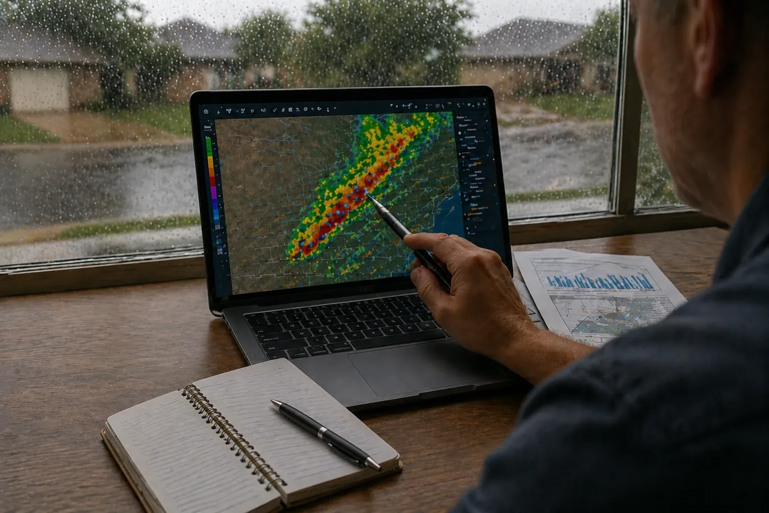
The National Hurricane Center publishes Tropical Cyclone Reports with landfall details, wind observations, and surge information. The National Weather Service Lake Charles office, which covers Jefferson County, publishes event summaries and local observations. NOAA's Storm Events Database lists reported wind, flood, and surge events by county. These records can support when and where damaging wind occurred compared with when water rose. Our storm lookup tool and weather events page are good starting points for your address and date.
Mitigation records
Water mitigation companies take moisture readings and often produce moisture maps showing which materials were wet and how high. Those maps can show moisture in the ceiling and upper walls of a room that also had floor-level flooding, helping separate the two causes.
Working with separate TWIA and flood adjusters
When a hurricane hits Port Arthur, you may have two or three adjusters on the same property, each working for a different insurer and each focused on the peril their policy covers. That creates predictable problems:
- The wind adjuster may attribute interior damage to flood, which TWIA does not cover.
- The flood adjuster may attribute damage to wind or rain, which the flood policy does not cover.
- Damage in the middle of a wall, such as wet drywall two to four feet up, could be claimed by neither.
- Each estimate may use different scopes, prices, and depreciation.
A few practical steps help:
- Report to every insurer promptly. TWIA says the deadline to report a claim is one year from the date of damage, with possible extension for good cause, but earlier reporting is almost always better. Flood policies have their own requirements, including strict proof of loss rules. Read your flood policy as soon as a loss happens.
- Get copies of each estimate. Compare what each adjuster included. Gaps and overlaps become obvious when the scopes are side by side.
- Ask each adjuster how they allocated the damage. Request any engineering report the insurer relies on.
- Do not sign broad releases or proof of loss forms you do not understand. Ask questions first.
- Keep the evidence. Save samples of damaged materials when practical and photograph anything removed.
Our TWIA windstorm claims and flood damage claims pages describe how a public adjuster can help coordinate both sides. For a step-by-step look at TWIA specifically, see our TWIA windstorm claim guide.
Anti-concurrent causation language in plain English
Some property policies include what is often called anti-concurrent causation (ACC) language. The general idea is that if an excluded cause, like flood, contributes to a loss at the same time or in any sequence with a covered cause, like wind, the loss is excluded. The wording often appears near the start of the exclusions section and may say something like "regardless of any other cause or event contributing concurrently or in any sequence to the loss."
Why it matters: in a hurricane, wind and water often combine. An insurer may argue that ACC wording excludes damage that both wind and flood contributed to. Policyholders may argue that specific damage was caused by wind alone and can be separated from the flood damage.
How ACC language applies depends on the exact policy form, the facts, and how Texas courts have interpreted similar wording. That is a legal question. If an insurer relies on ACC language to deny a significant part of your claim, talk to a Texas attorney. What a public adjuster can do is document the damage so the wind-caused portion is clearly separated and supported, which is usually the strongest practical position whether or not ACC language is in play.
Look at the exclusions section of your homeowners or commercial policy for flood, surface water, and any "concurrently or in any sequence" wording. Check whether your TWIA and flood policies are current. NFIP coverage generally has a 30-day waiting period, so buying it when a storm is already in the Gulf is usually too late.
A real-world pattern: surge vs. wind along the upper Texas coast
Hurricane Ike made landfall at Galveston on September 13, 2008 as a Category 2, well down the coast from Port Arthur. Even so, NOAA's Storm Events Database records a 14 to 15 foot storm surge at Sabine Pass, the highest water level ever recorded there. The surge did not top the Port Arthur seawall, but wave action on top of the surge did, and at least 100 homes flooded in Port Arthur. The surge also backed up Hillebrandt and Taylor Bayous and the Neches River, and NOAA records at least 4,000 homes flooded countywide. At the same time, a separate NOAA entry describes Category 1 wind damage across Jefferson County, with trees and power lines down on homes and businesses.
That is exactly the kind of storm where allocation fights happen: the same house in Hillebrandt or Sabine Pass could have a tree through the roof from wind and several feet of surge water inside. Each part belongs to a different policy, and each insurer will look hard at the other cause.
Harvey in 2017 was the opposite pattern for much of Port Arthur. The damage was mostly from extreme rainfall flooding, with NWS Lake Charles reporting more than 64,000 homes flooded in Jefferson County. For owners without flood insurance, that kind of loss may fall outside both the homeowners and TWIA policies, which is why flood coverage deserves serious thought even inside the levee. Read more on our storm history page.
How a Port Arthur Public Adjuster can help with mixed-cause claims
A licensed public adjuster represents the policyholder only, not the insurer. On a wind vs. flood claim, that typically means inspecting the property, documenting damage above and below the water line, pulling weather data for the date of loss, preparing a detailed estimate (often in Xactimate), and presenting a clear allocation to each insurer. Port Arthur Public Adjuster can also review the estimates you have already received to look for scope that fell between the policies.
Fees are disclosed in a written contract before any work begins; Texas law caps public adjuster compensation at 10% of the insurance settlement. No adjuster can promise a particular result, and coverage always depends on the policy and the facts. If you are dealing with a hurricane damage claim that has been split between insurers, a Port Arthur Public Adjuster review can help you see where you stand.
The bottom line
In Port Arthur, wind vs. flood damage is not an academic distinction. It decides which insurer pays and how much. Document the water line, document everything above it, record your timeline, pull the weather data, and report to every insurer that may be involved. The better the evidence separating wind from water, the harder it is for any insurer to push your damage onto someone else's policy.
Frequently Asked Questions
Does TWIA cover flood or storm surge damage?
No. TWIA policies cover wind and hail. Damage from flood, including storm surge and rising water, is generally excluded and is handled by a National Flood Insurance Program (NFIP) policy or a private flood policy, if you have one.
Is wind-driven rain considered flood damage?
Generally no. Rain that enters through an opening created by wind, such as a torn roof or broken window, is usually evaluated under the wind or property policy. Many policies only cover interior rain damage when wind or hail first creates that opening, so documenting the opening matters.
Do I need to file separate wind and flood claims after a hurricane?
If you have separate policies, yes. Many Port Arthur owners have a homeowners policy, a TWIA wind policy, and a flood policy. Each insurer usually assigns its own adjuster and applies its own deductible. Report the loss to every insurer that may be involved; do not assume one will notify the other.
What is anti-concurrent causation language?
It is wording in some policies that excludes a loss when an excluded cause, such as flood, contributes to the damage at the same time as a covered cause, such as wind. Whether and how it applies depends on the exact policy language and the facts. Questions about how courts interpret it should go to a Texas attorney.
What if the wind adjuster says it was flood and the flood adjuster says it was wind?
This happens. The best response is evidence: water lines, photos of upper-wall and ceiling damage, roof and window openings, timing of events, mitigation moisture maps, and weather data for your location. A public adjuster can help organize that evidence and present an allocation to each insurer. Coverage disputes may also call for advice from a Texas attorney.
Does the Port Arthur levee system mean I do not need flood insurance?
The city's hurricane flood protection system reduces storm surge risk, but it does not stop rainfall flooding. Harvey and Imelda both caused widespread flooding in Jefferson County from extreme rain. Whether flood coverage makes sense is a decision to make with your agent.
Sources and further reading
- Texas Department of Insurance: Windstorm general questions (TWIA catastrophe area)
- FloodSmart (NFIP): How to start your flood claim
- NOAA NCEI Storm Events: Hurricane Ike storm surge, Jefferson County (Sept. 12, 2008)
- NOAA NCEI Storm Events: Hurricane Ike wind damage, Jefferson County (Sept. 12, 2008)
- Texas Windstorm Insurance Association: FAQs
This article is general information about property insurance claims in Texas, not legal advice, and not a promise of any coverage or outcome. Your policy language and the facts of your loss control your claim.