
Bevil Oaks
Stream gage is indicating above bank full.
Source: NWS Local Storm Report · Reported by Mesonet
Last verified Oct 19, 2026 7:11 PM CDT
Automatically Updated
Preliminary wind, hail, tornado, and flood reports for Jefferson County from the National Weather Service, collected automatically so you can see what was reported and when.
163 storm reports for Jefferson County on file · Last updated Oct 19, 2026 9:05 PM CDT. Sources: National Weather Service Lake Charles Local Storm Reports (via api.weather.gov and the Iowa Environmental Mesonet LSR archive).
Stream gage is indicating above bank full.
Source: NWS Local Storm Report · Reported by Mesonet
Last verified Oct 19, 2026 7:11 PM CDT
Stream gage reporting water is out of the bank.
Source: NWS Local Storm Report · Reported by Mesonet
Last verified Oct 19, 2026 7:11 PM CDT
Stream gage reporting water over the banks.
Source: NWS Local Storm Report · Reported by Mesonet
Last verified Oct 19, 2026 7:11 PM CDT
Report from mPING: Street/road flooding; Street/road closed; Vehicles stranded.
Source: NWS Local Storm Report · Reported by Public
Last verified Oct 19, 2026 7:11 PM CDT
Public reports water entering home near Major Dr and Tolivar Rd in Beaumont.
Source: NWS Local Storm Report · Reported by Public
Last verified Oct 19, 2026 7:11 PM CDT
ASOS station KBMT Beaumont.
Source: NWS Local Storm Report · Reported by ASOS
Last verified Oct 19, 2026 7:11 PM CDT
Report from mPING: Street/road flooding; Street/road closed; Vehicles stranded.
Source: NWS Local Storm Report · Reported by Public
Last verified Oct 19, 2026 7:11 PM CDT
Report from mPING: Street/road flooding; Street/road closed; Vehicles stranded.
Source: NWS Local Storm Report · Reported by Public
Last verified Oct 19, 2026 7:11 PM CDT
REPORTED AT ALL SAINTS SCHOOL.
Source: NWS Local Storm Report · Reported by Mesonet
Last verified Oct 19, 2026 7:11 PM CDT
Source: NWS Local Storm Report · Reported by Mesonet
Last verified Oct 19, 2026 7:11 PM CDT
REPORTED AT RC SERVICES.
Source: NWS Local Storm Report · Reported by Mesonet
Last verified Oct 19, 2026 7:11 PM CDT
REPORTED AT GATOR COUNTRY.
Source: NWS Local Storm Report · Reported by Mesonet
Last verified Oct 19, 2026 7:11 PM CDT
Source: NWS Local Storm Report · Reported by Mesonet
Last verified Oct 19, 2026 7:11 PM CDT
Source: NWS Local Storm Report · Reported by Mesonet
Last verified Oct 19, 2026 7:11 PM CDT
ASOS station KBMT Beaumont.
Source: NWS Local Storm Report · Reported by ASOS
Last verified Oct 19, 2026 7:11 PM CDT
Source: NWS Local Storm Report · Reported by Mesonet
Last verified Oct 19, 2026 7:11 PM CDT
Source: NWS Local Storm Report · Reported by Mesonet
Last verified Oct 19, 2026 7:11 PM CDT
Source: NWS Local Storm Report · Reported by Mesonet
Last verified Oct 19, 2026 7:11 PM CDT
Mesonet station FADT2 Mcfaddin.
Source: NWS Local Storm Report · Reported by Mesonet
Last verified Oct 19, 2026 7:11 PM CDT
ASOS station KBPT Southeast Texas Regional Airport.
Source: NWS Local Storm Report · Reported by ASOS
Last verified Oct 19, 2026 7:11 PM CDT
Source: NWS Local Storm Report · Reported by Mesonet
Last verified Oct 19, 2026 7:11 PM CDT
Source: NWS Local Storm Report · Reported by Mesonet
Last verified Oct 19, 2026 7:11 PM CDT
Mesonet station SRST2 1 ESE Sea Rim State Park.
Source: NWS Local Storm Report · Reported by Mesonet
Last verified Oct 19, 2026 7:11 PM CDT
Source: NWS Local Storm Report · Reported by Mesonet
Last verified Oct 19, 2026 7:11 PM CDT
Source: NWS Local Storm Report · Reported by Mesonet
Last verified Oct 19, 2026 7:11 PM CDT
Mesonet station PRTNC 1 NW Port Neches.
Source: NWS Local Storm Report · Reported by Mesonet
Last verified Oct 19, 2026 7:11 PM CDT
Source: NWS Local Storm Report · Reported by Mesonet
Last verified Oct 19, 2026 7:11 PM CDT
Mesonet station HOWEP 5 SSW Port Arthur.
Source: NWS Local Storm Report · Reported by Mesonet
Last verified Oct 19, 2026 7:11 PM CDT
Source: NWS Local Storm Report · Reported by Mesonet
Last verified Oct 19, 2026 7:11 PM CDT
ASOS station KBPT Southeast Texas Regional Airport.
Source: NWS Local Storm Report · Reported by ASOS
Last verified Oct 19, 2026 7:11 PM CDT
Buoy station PORT2 Port Arthur, TX.
Source: NWS Local Storm Report · Reported by Buoy
Last verified Oct 19, 2026 7:11 PM CDT
ASOS station KBPT Southeast Texas Regional Airport.
Source: NWS Local Storm Report · Reported by ASOS
Last verified Oct 19, 2026 7:11 PM CDT
Source: NWS Local Storm Report · Reported by Mesonet
Last verified Oct 19, 2026 7:11 PM CDT
Buoy station PORT2 Port Arthur, TX.
Source: NWS Local Storm Report · Reported by Buoy
Last verified Oct 19, 2026 7:11 PM CDT
Mesonet station SRST2 1 ESE Sea Rim State Park.
Source: NWS Local Storm Report · Reported by Mesonet
Last verified Oct 19, 2026 7:11 PM CDT
ASOS station KBPT Southeast Texas Regional Airport.
Source: NWS Local Storm Report · Reported by ASOS
Last verified Oct 19, 2026 7:11 PM CDT
From Jefferson County Drainage District 7, lots of streets flooding with water in homes.
Source: NWS Local Storm Report · Reported by Emergency Mngr
Last verified Oct 19, 2026 7:11 PM CDT
DELAYED REPORT. Numerous photos and videos of flooding between Nederland and Port Arthur, TX.
Source: NWS Local Storm Report · Reported by Public
Last verified Oct 19, 2026 7:11 PM CDT
Reports of water entering homes in Groves.
Source: NWS Local Storm Report · Reported by Public
Last verified Oct 19, 2026 7:11 PM CDT
Water level station shows water out of the banks.
Source: NWS Local Storm Report · Reported by Public
Last verified Oct 19, 2026 7:11 PM CDT
Gauge site on Lawhon Road indicates the creek out of its bank and rising slowly.
Source: NWS Local Storm Report · Reported by Mesonet
Last verified Oct 19, 2026 7:11 PM CDT
Picture of significant street flooding and gages in the area did indicate water out of banks.
Source: NWS Local Storm Report · Reported by Local Official
Last verified Oct 19, 2026 7:11 PM CDT
Photo received of downed tree in Fannett. Time estimated by radar.
Source: NWS Local Storm Report · Reported by Broadcast Media
Last verified Oct 19, 2026 7:11 PM CDT
KFDM mesonet.
Source: NWS Local Storm Report · Reported by Mesonet
Last verified Oct 19, 2026 7:11 PM CDT
Measured by KFDM mesonet at Utophia Ranch.
Source: NWS Local Storm Report · Reported by Mesonet
Last verified Oct 19, 2026 7:11 PM CDT
NOS Station NWLON Port Arthur recorded a wind gust of 41 MPH.
Source: NWS Local Storm Report · Reported by C-Man Station
Last verified Oct 19, 2026 7:11 PM CDT
Corrects previous flash flood report from 5 E Bevil Oaks for PM instead of AM. several flood reports in the Bor-Ley Heights subdivision. At least one home got water in it.
Source: NWS Local Storm Report · Reported by Public
Last verified Oct 19, 2026 7:11 PM CDT
several flood reports in the Bor-Ley Heights subdivision. At least one home got water in it.
Source: NWS Local Storm Report · Reported by Public
Last verified Oct 19, 2026 7:11 PM CDT
Underpass on South 4th near Crockett Street filled to near the top.
Source: NWS Local Storm Report · Reported by Public
Last verified Oct 19, 2026 7:11 PM CDT
6 inches of water covering parts of Franklin Street near downtown Beaumont.
Source: NWS Local Storm Report · Reported by Public
Last verified Oct 19, 2026 7:11 PM CDT
Waashington Blvd toward MLK in downtown Beaumont reported flooded and impassable.
Source: NWS Local Storm Report · Reported by Public
Last verified Oct 19, 2026 7:11 PM CDT
Water level gage reported water just under 2 feet over the roadway.
Source: NWS Local Storm Report · Reported by Mesonet
Last verified Oct 19, 2026 7:11 PM CDT
11th street completely flooded.
Source: NWS Local Storm Report · Reported by Public
Last verified Oct 19, 2026 7:11 PM CDT
Streets flooded and impassable in the Central Gardens area.
Source: NWS Local Storm Report · Reported by Public
Last verified Oct 19, 2026 7:11 PM CDT
Water level gage showed water over a foot out of the banks.
Source: NWS Local Storm Report · Reported by Mesonet
Last verified Oct 19, 2026 7:11 PM CDT
Water level gage reported water well out of the banks.
Source: NWS Local Storm Report · Reported by Mesonet
Last verified Oct 19, 2026 7:11 PM CDT
College and MLK streets totally flooded.
Source: NWS Local Storm Report · Reported by Public
Last verified Oct 19, 2026 7:11 PM CDT
Cars stalled near North 11th St and the I-10 Service Road.
Source: NWS Local Storm Report · Reported by Public
Last verified Oct 19, 2026 7:11 PM CDT
Lightning struck a storage tank on Proctor St Ext and started a fire that spread to another nearby tank.
Source: NWS Local Storm Report · Reported by Broadcast Media
Last verified Oct 19, 2026 7:11 PM CDT
Corrects previous flash flood report from 4 WSW Beaumont. Water level gage reported water just under 2 feet over the roadway.
Source: NWS Local Storm Report · Reported by Mesonet
Last verified Oct 19, 2026 7:11 PM CDT
KBMT reports flooding along several roads in Beaumont including U.S. Hwy 69 feeder road in front of Classic Chevrolet, Intersection of College St & MLK Pkwy, Wall & MLK Park St underpass in downtown Beaumont, Orleans Underpass, I-10 feeder road in front of Babe Zaharias Park, and Fourth St. and Cedar.
Source: NWS Local Storm Report · Reported by Broadcast Media
Last verified Oct 19, 2026 7:11 PM CDT
Water level gage indicates water out of the banks.
Source: NWS Local Storm Report · Reported by Mesonet
Last verified Oct 19, 2026 7:11 PM CDT
Water level gage reports water over the road.
Source: NWS Local Storm Report · Reported by Mesonet
Last verified Oct 19, 2026 7:11 PM CDT
Water level gage indicates water is out of bank.
Source: NWS Local Storm Report · Reported by Mesonet
Last verified Oct 19, 2026 7:11 PM CDT
Video of flooding.
Source: NWS Local Storm Report · Reported by Broadcast Media
Last verified Oct 19, 2026 7:11 PM CDT
ASOS station KBPT Southeast Texas Regional Airport.
Source: NWS Local Storm Report · Reported by ASOS
Last verified Oct 19, 2026 7:11 PM CDT
Photo of tree damage sustained from a lightning strike.
Source: NWS Local Storm Report · Reported by Public
Last verified Oct 19, 2026 7:11 PM CDT
Report received via Facebook. Flag pole broken off and pool light blown down. Delayed report.
Source: NWS Local Storm Report · Reported by Public
Last verified Oct 19, 2026 7:11 PM CDT
Source: NWS Local Storm Report · Reported by C-Man Station
Last verified Oct 19, 2026 7:11 PM CDT
Source: NWS Local Storm Report · Reported by Broadcast Media
Last verified Oct 19, 2026 7:11 PM CDT
WeatherNet station at Sabine Pass school recorded a wind gust of 83 mph.
Source: NWS Local Storm Report · Reported by Mesonet
Last verified Oct 19, 2026 7:11 PM CDT
Source: NWS Local Storm Report · Reported by Broadcast Media
Last verified Oct 19, 2026 7:11 PM CDT
ASOS station KBPT Southeast Texas Regional Airport.
Source: NWS Local Storm Report · Reported by ASOS
Last verified Oct 19, 2026 7:11 PM CDT
ASOS station KBPT Southeast Texas Regional Airport.
Source: NWS Local Storm Report · Reported by ASOS
Last verified Oct 19, 2026 7:11 PM CDT
Cocorahs station TX-JJ-30 Beaumont 0.6 WNW.
Source: NWS Local Storm Report · Reported by Cocorahs
Last verified Oct 19, 2026 7:11 PM CDT
Cocorahs station TX-JJ-20 Beaumont 1.2 NW.
Source: NWS Local Storm Report · Reported by Cocorahs
Last verified Oct 19, 2026 7:11 PM CDT
Cocorahs station TX-JJ-18 Beaumont 0.8 NNE.
Source: NWS Local Storm Report · Reported by Cocorahs
Last verified Oct 19, 2026 7:11 PM CDT
Cocorahs station TX-JJ-3 Port Neches 1.0 W.
Source: NWS Local Storm Report · Reported by Cocorahs
Last verified Oct 19, 2026 7:11 PM CDT
Cocorahs station TX-JJ-29 Beaumont 4.8 NNW.
Source: NWS Local Storm Report · Reported by Cocorahs
Last verified Oct 19, 2026 7:11 PM CDT
Reported from Beauxart Gardens.
Source: NWS Local Storm Report · Reported by Broadcast Media
Last verified Oct 19, 2026 7:11 PM CDT
Source: NWS Local Storm Report · Reported by Public
Last verified Oct 19, 2026 7:11 PM CDT
Source: NWS Local Storm Report · Reported by Broadcast Media
Last verified Oct 19, 2026 7:11 PM CDT
Source: NWS Local Storm Report · Reported by Broadcast Media
Last verified Oct 19, 2026 7:11 PM CDT
*** 2 INJ *** Six RVs were flipped along the west bank of Sabine Lake, Pleasure Island. Two people were injured.
Source: NWS Local Storm Report · Reported by NWS Storm Survey
Last verified Oct 19, 2026 7:11 PM CDT
*** 1 INJ *** Report of a minor injury as a motorist was caught in the tornado crossing Jefferson County earlier. Time and location approximate.
Source: NWS Local Storm Report · Reported by Emergency Mngr
Last verified Oct 19, 2026 7:11 PM CDT
*** 1 INJ *** Tornado continued into southwest Jefferson County from Chambers County. It snapped off power poles at French Rd before continuing northeast. An area of trees were snapped off and uprooted just south of the Big Hill Strategic Oil Reserve. Tornado continued northeast where it destroyed the top floor of the Sabine Ranch Lodge, stripped metal from a nearby industrial building, flipped a car into a side yard, and damaged the roofs of two homes. The car contained two people, one sustained a minor injury. The tornado crossed Hwys 87 and 82 where it snapped transmission poles. Finally, it moved overtop Sabine Lake. Track likely continued into western Cameron Parish. Further analysis wi
Source: NWS Local Storm Report · Reported by NWS Storm Survey
Last verified Oct 19, 2026 7:11 PM CDT
Local stream gage indicates water is starting to go over the banks.
Source: NWS Local Storm Report · Reported by Mesonet
Last verified Oct 19, 2026 7:11 PM CDT
stream gage shows water is over Landis Drive.
Source: NWS Local Storm Report · Reported by Mesonet
Last verified Oct 19, 2026 7:11 PM CDT
911 reported water over the roads near I-10 north of Hampshire.
Source: NWS Local Storm Report · Reported by Law Enforcement
Last verified Oct 19, 2026 7:11 PM CDT
Gauge reports water was out of the ditches near Terrell Ave.
Source: NWS Local Storm Report · Reported by Mesonet
Last verified Oct 19, 2026 7:11 PM CDT
Water level gage reports water is out of the banks on Berry Drive.
Source: NWS Local Storm Report · Reported by Mesonet
Last verified Oct 19, 2026 7:11 PM CDT
Delayed report. Site for Neches River at Downtown Beaumont reached minor flood stage.
Source: NWS Local Storm Report · Reported by Mesonet
Last verified Oct 19, 2026 7:11 PM CDT
Stream gage reports water out of banks.
Source: NWS Local Storm Report · Reported by Mesonet
Last verified Oct 19, 2026 7:11 PM CDT
2.73 MHHW.
Source: NWS Local Storm Report · Reported by C-Man Station
Last verified Oct 19, 2026 7:11 PM CDT
Delayed report. Emergency manager reports water surged across portions of highway 87 at Texas Point. Time estimated from water levels at NOS Texas Point CMAN.
Source: NWS Local Storm Report · Reported by Emergency Mngr
Last verified Oct 19, 2026 7:11 PM CDT
Mesonet station FADT2 Mcfaddin.
Source: NWS Local Storm Report · Reported by Mesonet
Last verified Oct 19, 2026 7:11 PM CDT
Mesonet station FW9386 Taylor Landing.
Source: NWS Local Storm Report · Reported by Mesonet
Last verified Oct 19, 2026 7:11 PM CDT
ASOS station KBPT Southeast Texas Regional Airport.
Source: NWS Local Storm Report · Reported by ASOS
Last verified Oct 19, 2026 7:11 PM CDT
3.1 MHHW measured.
Source: NWS Local Storm Report · Reported by C-Man Station
Last verified Oct 19, 2026 7:11 PM CDT
Public submitted a video to broadcast media of a possible tornado near 11th street and North street as well as Martin Luther King and I-10.
Source: NWS Local Storm Report · Reported by Public
Last verified Oct 19, 2026 7:11 PM CDT
Gauge at Taylor Bayou at Craigen Road reached minor flood stage and continued rising.
Source: NWS Local Storm Report · Reported by Mesonet
Last verified Oct 19, 2026 7:11 PM CDT
Gauge at Green Pond Road indicates water came out of the ditch and continued rising.
Source: NWS Local Storm Report · Reported by Mesonet
Last verified Oct 19, 2026 7:11 PM CDT
Potions of MLK Parkway and several side streets were flooded.
Source: NWS Local Storm Report · Reported by NWS Employee
Last verified Oct 19, 2026 7:11 PM CDT
Gauge at South China Road indicates water came out of the ditch.
Source: NWS Local Storm Report · Reported by Mesonet
Last verified Oct 19, 2026 7:11 PM CDT
Public reports water over roadways in Port Neches.
Source: NWS Local Storm Report · Reported by Public
Last verified Oct 19, 2026 7:11 PM CDT
Buoy station PORT2 Port Arthur, TX.
Source: NWS Local Storm Report · Reported by Buoy
Last verified Oct 19, 2026 7:11 PM CDT
ASOS station KBPT Southeast Texas Regional Airport.
Source: NWS Local Storm Report · Reported by ASOS
Last verified Oct 19, 2026 7:11 PM CDT
Public reports a measured 73 MPH wind gust on a personal Ambient Weather Station.
Source: NWS Local Storm Report · Reported by Public
Last verified Oct 19, 2026 7:11 PM CDT
Report from mPING: 3-inch tree limbs broken; Power poles broken.
Source: NWS Local Storm Report · Reported by Public
Last verified Oct 19, 2026 7:11 PM CDT
Portions of 380 closed due to high water.
Source: NWS Local Storm Report · Reported by Dept of Highways
Last verified Oct 19, 2026 7:11 PM CDT
Buoy station PORT2 Port Arthur, TX.
Source: NWS Local Storm Report · Reported by Buoy
Last verified Oct 19, 2026 7:11 PM CDT
Report from mPING: Street/road flooding; Street/road closed; Vehicles stranded.
Source: NWS Local Storm Report · Reported by Public
Last verified Oct 19, 2026 7:11 PM CDT
Report of wind gust to 55 MPH east of China.
Source: NWS Local Storm Report · Reported by Public
Last verified Oct 19, 2026 7:11 PM CDT
Gauge for Pine Island Bayou at BI Pump Plant reached minor flood.
Source: NWS Local Storm Report · Reported by Mesonet
Last verified Oct 19, 2026 7:11 PM CDT
ASOS station KBPT Southeast Texas Regional Airport.
Source: NWS Local Storm Report · Reported by ASOS
Last verified Oct 19, 2026 7:11 PM CDT
Street flooding reported across several areas. Along the track of the supercell.
Source: NWS Local Storm Report · Reported by Amateur Radio
Last verified Oct 19, 2026 7:11 PM CDT
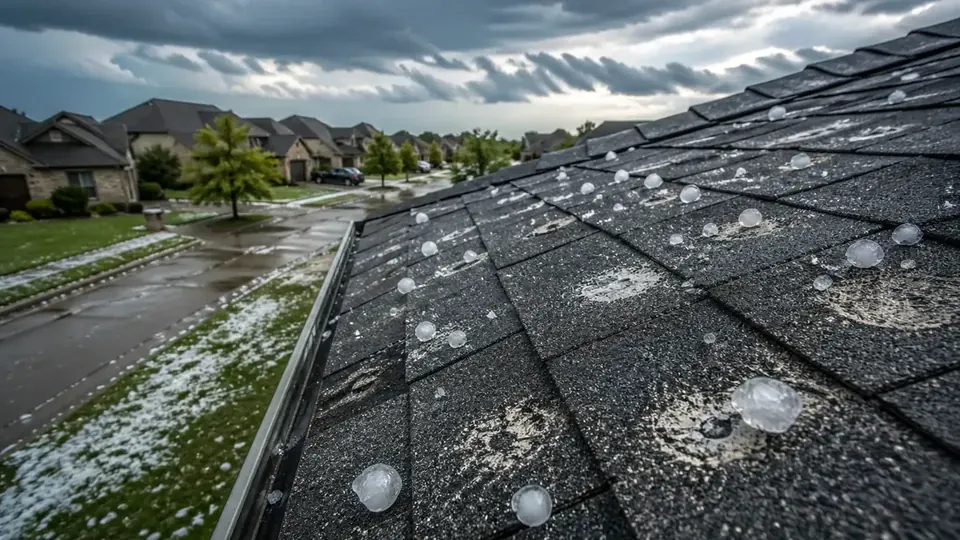
Hail from golfball to hen egg size reported at Groves.
Source: NWS Local Storm Report · Reported by Public
Last verified Oct 19, 2026 7:11 PM CDT
Call from the public about 3/4 to quarter sized hail.
Source: NWS Local Storm Report · Reported by Public
Last verified Oct 19, 2026 7:11 PM CDT
Report from mPING: Quarter (1.00 in.).
Source: NWS Local Storm Report · Reported by Public
Last verified Oct 19, 2026 7:11 PM CDT
Helicopter spun around and a boarding stairway was blown down the tarmac. The ASOS had winds 22G56MPH before the sensor stopped reporting for about 10 minutes. Higher winds certainly possible.
Source: NWS Local Storm Report · Reported by Public
Last verified Oct 19, 2026 7:11 PM CDT
Video of ping pong ball size hail at Fannett.
Source: NWS Local Storm Report · Reported by Public
Last verified Oct 19, 2026 7:11 PM CDT
Several pictures from the public and media of large hail north of Hampshire.
Source: NWS Local Storm Report · Reported by Public
Last verified Oct 19, 2026 7:11 PM CDT
Lightning struck a home causing a house fire on Pine Island Road. No injuries occurred.
Source: NWS Local Storm Report · Reported by Broadcast Media
Last verified Oct 19, 2026 7:11 PM CDT
TXDot reports water over Nall Street.
Source: NWS Local Storm Report · Reported by Dept of Highways
Last verified Oct 19, 2026 7:11 PM CDT
Gage reporting water is out of the banks on North Fork of Taylors Bayou.
Source: NWS Local Storm Report · Reported by Mesonet
Last verified Oct 19, 2026 7:11 PM CDT
Gage reports water well out of the banks and approaching McDermond Road.
Source: NWS Local Storm Report · Reported by Mesonet
Last verified Oct 19, 2026 7:11 PM CDT
Roads flooded near 347/366.
Source: NWS Local Storm Report · Reported by Dept of Highways
Last verified Oct 19, 2026 7:11 PM CDT
380 Closed in Beaumont due to flooding.
Source: NWS Local Storm Report · Reported by Dept of Highways
Last verified Oct 19, 2026 7:11 PM CDT
Gage shows minor flooding on the west side of Bevil Oaks.
Source: NWS Local Storm Report · Reported by Mesonet
Last verified Oct 19, 2026 7:11 PM CDT
Parts of Heatherbrook are under water.
Source: NWS Local Storm Report · Reported by Public
Last verified Oct 19, 2026 7:11 PM CDT
gage showing ditch on Berry Drive is out of its banks.
Source: NWS Local Storm Report · Reported by Mesonet
Last verified Oct 19, 2026 7:11 PM CDT
Ditch on Landis Drive is out of its banks and approaching the road.
Source: NWS Local Storm Report · Reported by Mesonet
Last verified Oct 19, 2026 7:11 PM CDT
Report from mPING: Street/road flooding; Street/road closed.
Source: NWS Local Storm Report · Reported by Public
Last verified Oct 19, 2026 7:11 PM CDT
Reported flooding at Spurlock and Twin City HWY.
Source: NWS Local Storm Report · Reported by Amateur Radio
Last verified Oct 19, 2026 7:11 PM CDT
Ditc on South 8th is out of its banks.
Source: NWS Local Storm Report · Reported by Mesonet
Last verified Oct 19, 2026 7:11 PM CDT
Some underpasses are flooded in the Beaumont area.
Source: NWS Local Storm Report · Reported by Public
Last verified Oct 19, 2026 7:11 PM CDT
Trees blown down in the area and a commercial building has damage to a garage door.
Source: NWS Local Storm Report · Reported by Public
Last verified Oct 19, 2026 7:11 PM CDT
Photo of a tree and powerlines down on a flooded road.
Source: NWS Local Storm Report · Reported by Public
Last verified Oct 19, 2026 7:11 PM CDT
numerous trees down in Nederland.
Source: NWS Local Storm Report · Reported by Broadcast Media
Last verified Oct 19, 2026 7:11 PM CDT
Report from mPING: Street/road flooding; Street/road closed; Vehicles stranded.
Source: NWS Local Storm Report · Reported by Public
Last verified Oct 19, 2026 7:11 PM CDT
Report from mPING: Street/road flooding; Street/road closed; Vehicles stranded.
Source: NWS Local Storm Report · Reported by Public
Last verified Oct 19, 2026 7:11 PM CDT
Report from mPING: Street/road flooding; Street/road closed; Vehicles stranded.
Source: NWS Local Storm Report · Reported by Public
Last verified Oct 19, 2026 7:11 PM CDT
St. 2400 M.H.M.R. South 8th Street @ Ditch 110 out of banks.
Source: NWS Local Storm Report · Reported by Mesonet
Last verified Oct 19, 2026 7:11 PM CDT
Broadcast Media sent video of significant damage to commercial buildings and power infrastructure. Time estimated by radar.
Source: NWS Local Storm Report · Reported by Broadcast Media
Last verified Oct 19, 2026 7:11 PM CDT
Tornado damage became apparent near the intersection of 17th Street and Savannah Ave southeast of Motiva. The tornado path traveled east, peaking out near the Progressive Missionary Baptist Church where a large portion of the masonry walls collapsed. Another home near 11th Street and Orange Ave had the roof completely removed and some walls collapsed. Numerous homes sustained roof damage along the path along many trees downed or damaged. The path continued across Rose Hill Park and onto Pleasure Island. The tornado may have continued into Sabine Lake. The tornado lasted for roughly 4 minutes with peak winds estimated near 120 mph, making it an EF2.
Source: NWS Local Storm Report · Reported by NWS Storm Survey
Last verified Oct 19, 2026 7:11 PM CDT
ASOS station KBPT Southeast Texas Regional Airport.
Source: NWS Local Storm Report · Reported by ASOS
Last verified Oct 19, 2026 7:11 PM CDT
Mesonet station FADT2 Mcfaddin.
Source: NWS Local Storm Report · Reported by Mesonet
Last verified Oct 19, 2026 7:11 PM CDT
A trailer was overturned due to severe thunderstorm wind gust at the South Texas State Fair at Ford Park.
Source: NWS Local Storm Report · Reported by Local Official
Last verified Oct 19, 2026 7:11 PM CDT
Photo of half dollar size hail near Bevil Oaks. Time estimated by radar.
Source: NWS Local Storm Report · Reported by Public
Last verified Oct 19, 2026 7:11 PM CDT
Story of a trees down across 7100 Tram Rd, Beaumont, TX.
Source: NWS Local Storm Report · Reported by Broadcast Media
Last verified Oct 19, 2026 7:11 PM CDT
Water level gage reports water is back out of the banks.
Source: NWS Local Storm Report · Reported by Mesonet
Last verified Oct 19, 2026 7:11 PM CDT
Mayhaw Bayou out of its banks.
Source: NWS Local Storm Report · Reported by Mesonet
Last verified Oct 19, 2026 7:11 PM CDT
Stream gauge exceeded bank full.
Source: NWS Local Storm Report · Reported by Mesonet
Last verified Oct 19, 2026 7:11 PM CDT
St. 2400 M.H.M.R. South 8th Street @ Ditch 110 exceeded bank full.
Source: NWS Local Storm Report · Reported by Public
Last verified Oct 19, 2026 7:11 PM CDT
Green Acres Screw Gate exceeded bank full.
Source: NWS Local Storm Report · Reported by Mesonet
Last verified Oct 19, 2026 7:11 PM CDT
Stream gauge northwest of Hamshire topped the ditch.
Source: NWS Local Storm Report · Reported by Mesonet
Last verified Oct 19, 2026 7:11 PM CDT
North Fork Taylors Bayou & Boondocks Rd exceeded bank full.
Source: NWS Local Storm Report · Reported by Mesonet
Last verified Oct 19, 2026 7:11 PM CDT
Gauge reports Taylor Bayou at Craigen Rd is at Minor Flood.
Source: NWS Local Storm Report · Reported by Mesonet
Last verified Oct 19, 2026 7:11 PM CDT
Water level gage on Bayou Din at mack road indicates water is well out of the banks.
Source: NWS Local Storm Report · Reported by Mesonet
Last verified Oct 19, 2026 7:11 PM CDT
Water level station at powers road and cliff drive indicates water is out of the banks.
Source: NWS Local Storm Report · Reported by Mesonet
Last verified Oct 19, 2026 7:11 PM CDT
Water is out of the banks.
Source: NWS Local Storm Report · Reported by Mesonet
Last verified Oct 19, 2026 7:11 PM CDT
Water level gage indicates flooding.
Source: NWS Local Storm Report · Reported by Mesonet
Last verified Oct 19, 2026 7:11 PM CDT
Water well out of its banks.
Source: NWS Local Storm Report · Reported by Mesonet
Last verified Oct 19, 2026 7:11 PM CDT
Preliminary data. Local Storm Reports are preliminary reports from spotters, emergency managers, the public, and instruments. Sizes, speeds, times, and locations can be estimated and may later be revised. The verified record is published later in the NOAA Storm Events Database. A nearby weather report does not prove that damage occurred at a specific property; physical inspection is still required.